Global high-resolution mapping of seagrass to support conservationWereldwijde hoge-resolutie mapping van zeegras ter ondersteuning van behoudCartographie mondiale haute résolution des herbiers marins pour soutenir la conservation
Nature · 25 June 2026, at 07:24
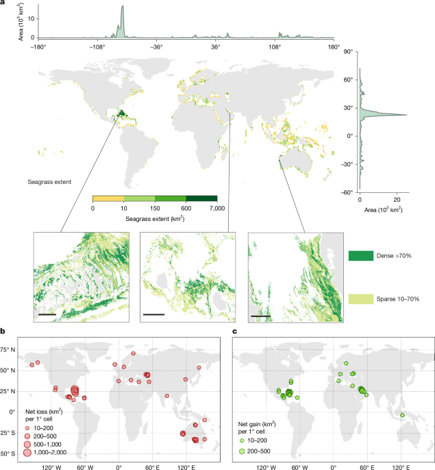
I find it fascinating that researchers have created a high-resolution map of seagrass ecosystems worldwide! This mapping is crucial for conservation efforts, helping to protect these vital habitats that support marine biodiversity. Seagrasses play a significant role in carbon storage and coastal protection, which is more important than ever in our changing climate. By understanding where these meadows are located, we can better strategize their conservation and restoration.Ik vind het fascinerend dat onderzoekers een hoge-resolutie kaart hebben gemaakt van zeegrasecosystemen wereldwijd! Deze mapping is cruciaal voor behoudsinspanningen en helpt deze vitale habitats te beschermen die de mariene biodiversiteit ondersteunen. Zeegras speelt een belangrijke rol in koolstofopslag en kustbescherming, wat in ons veranderende klimaat belangrijker is dan ooit. Door te begrijpen waar deze grasvelden zich bevinden, kunnen we beter strategiseren voor hun behoud en herstel.Je trouve fascinant que des chercheurs aient créé une carte haute résolution des écosystèmes de herbiers marins dans le monde entier ! Cette cartographie est cruciale pour les efforts de conservation, aidant à protéger ces habitats vitaux qui soutiennent la biodiversité marine. Les herbiers jouent un rôle significatif dans le stockage du carbone et la protection côtière, ce qui est plus important que jamais dans notre climat changeant. En comprenant où se trouvent ces prairies, nous pouvons mieux planifier leur conservation et leur restauration.